



Cassini's map of France, an encyclopedia of the territory, at the National Archives
NATIONAL ARCHIVES MUSEUM – HÔTEL DE SOUBISE
From October 14, 2026 to February 1, 2027
Before Cassini's map, no one had seen all of France. The National Archives recount the surveying process that, village by village, gave it its face.



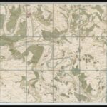



What is this place called? To map France, Cassini's cartographers also interviewed its inhabitants. From these names, measurements, and calculations emerged a truly immense undertaking: 181 sheets, approximately twelve meters high when assembled. The National Archives reveal the secrets and behind-the-scenes details of this extraordinary creation. Behind each symbol, a piece of land surveyed, an engraving, a decision. The kingdom learns to see itself and to govern itself. We discover, from village to village, all the perspectives it took to capture a country on paper.
Also featured in our Top new releases of the week.
NATIONAL ARCHIVES MUSEUM – HÔTEL DE SOUBISE
60 rue des Francs-Bourgeois, 75003 Paris – Metro: Rambuteau
From October 14, 2026 to February 1, 2027
Monday, Wednesday, Thursday, and Friday from 10:00 AM to 5:30 PM; Saturday and Sunday from 2:00 PM to 7:00 PM – Closed on Tuesdays
Free admission